


VTD-precinct 17, Beadle County, South Dakota
About
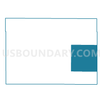
Outline

Summary
| Unique Area Identifier | 667001 |
| Name | VTD-precinct 17 |
| County | Beadle County |
| State | South Dakota |
| Area (square miles) | 142.81 |
| Land Area (square miles) | 142.81 |
| Water Area (square miles) | 0.00 |
| % of Land Area | 100.00 |
| % of Water Area | 0.00 |
| Latitude of the Internal Point | 44.36895190 |
| Longtitude of the Internal Point | -97.97346550 |
Maps


Graphs
Select a template below for downloading or customizing gragh for VTD-precinct 17, Beadle County, South Dakota


Neighbors
Neighoring Voting District (by Name) Neighboring Voting District on the Map
- VTD - precinct 1, Kingsbury County, SD
- VTD-Huron precinct W1, Beadle County, SD
- VTD-Huron precinct W7-1, Beadle County, SD
- VTD-Huron precinct W7-2, Beadle County, SD
- VTD-precinct 15, Beadle County, SD
Top 10 Neighboring County Subdivision (by Population) Neighboring County Subdivision on the Map
- Custer township, Beadle County, SD (410)
- Valley township, Beadle County, SD (262)
- Iroquois city, Kingsbury County, SD (200)
- Richland township, Beadle County, SD (128)
- Clifton township, Beadle County, SD (120)
- Logan township, Beadle County, SD (116)
- Cavour town, Beadle County, SD (114)
- Le Sueur township, Kingsbury County, SD (113)
- Cavour township, Beadle County, SD (108)
- Yale town, Beadle County, SD (108)